This EuroSea satellite event will take place on 17 September from 12:00 to 13:30 CEST, as part of the UN Ocean Decade Laboratory on the Predicted Ocean outcome. Led by EuroSea partners Arup, National Oceanography Centre, and University of Cambridge, this event will present a EuroSea prototype sea level rise planning and scenario visualization tool.
Projecting sea level rise is a key topic when talking about climate change. But what are the consequences (what economic damage can flooding have in certain regions, for example)? Where will it be needed to invest in targeted measures to prevent or minimize damage to citizens, companies, and properties?
The EuroSea tool will demonstrate the potential impacts of the full range of sea level rise scenarios such as sea level changes, waves, and inland flooding in terms of economic damages in an example location. The tool will allow users to see potential sea level rise impacts based on thousands of flood simulations within seconds.
Understanding and interacting with uncertainty involved in the sea level rise predictions will help decision makers, planners, and asset owners to anticipate changes and make robust plans in coastal locations. This tool will also interest sea level scientists who need a deeper knowledge of sea level rise scenarios.
Register here!
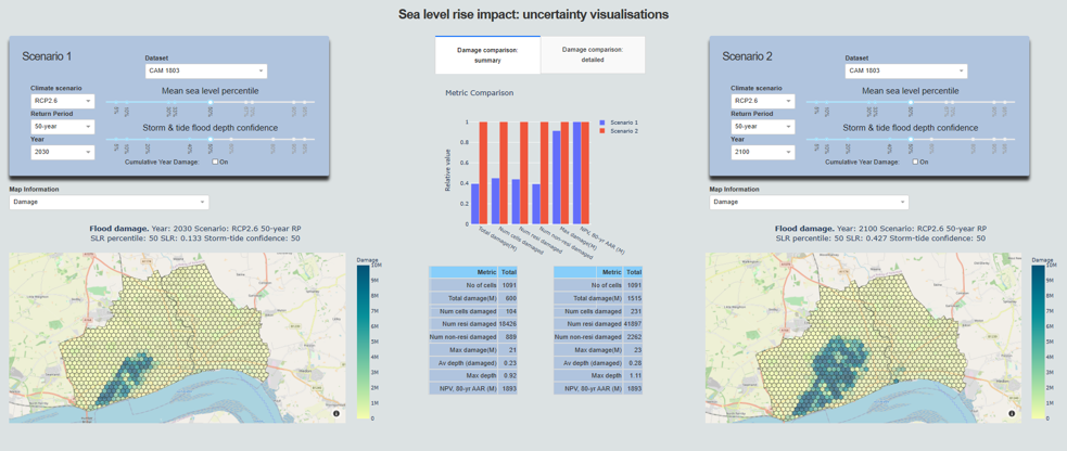
EuroSea prototype tool for sea level rise scenario prediction