Description
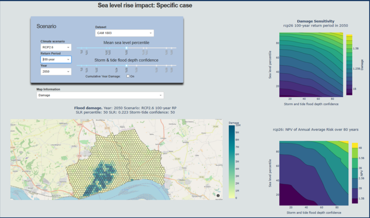
The tool, designed to aid local authorities and city planners, provides advanced visualization of various sea-level scenarios, enabling better comprehension of potential risks such as flooding. This informed understanding can immensely aid in decision-making processes regarding coastal planning and infrastructure investments.
Impact During the Project
Enhanced Decision Making and Forward Planning:
Traditional State: Prior to this tool, decisions related to coastal developments, city planning, and infrastructure were often based on static models and historical data, leading to potential under-preparations for future sea-level variations.
Advancement: The prototype provides dynamic, scenario-based visualizations, giving authorities a comprehensive and tangible insight into potential sea-level hazards. With this, they can make more informed, future-proof decisions regarding urban planning and infrastructure development.
Broad Understanding of Sea Level Projection Uncertainties:
Traditional State: Before, stakeholders may have had limited insights into the uncertainties associated with sea-level projections, leading to potentially skewed risk assessments.
Advancement: The tool not only provides projections but also clarifies the uncertainties associated with them, alongside their potential financial ramifications. This holistic understanding ensures that decision-makers can evaluate risks with a more comprehensive perspective, optimizing investments and preparations.
Impact Post Project
Scalable and Adaptable Tool for Broader Regions:
Traditional State: Earlier tools might have been rigid and tailored for specific regions or datasets, limiting their applicability elsewhere.
Advancement: The prototype is designed with scalability in mind. As interest grows, it can be adapted and tailored for various regions, making it a versatile tool for a broader range of stakeholders across different geographies.
Sustained Use and Continuous Improvement:
Traditional State: Traditional tools might have seen declining use after initial deployment due to them becoming outdated or not evolving with users’ needs.
Advancement: Feedback mechanisms, testimonials, and stakeholder testing ensure that the tool is not only continually validated but also improved upon based on real-world user feedback. This iterative development ensures that the tool remains relevant and useful in the long run.
Advancement over and above State of the Art
The introduction of the prototype sea level planning and scenario visualization tool represents a substantial step forward from traditional methods. Through dynamic visualizations, clearer presentations of uncertainty, and a focus on adaptability, the tool promises to revolutionize how local authorities and city planners approach sea-level challenges. Its potential for scalability ensures that its impact isn’t limited to its initial deployment regions, making it a powerful asset in global efforts to combat the challenges posed by changing sea levels.
Links and References
Link to details: https://www.arup.com/projects/sea-level-rise-insights-tool
Link to D5.1- Prototype sea level planning and scenario visualization tool: https://eurosea.eu/download/eurosea_d5-1_eurosea_prototype_sea_level_planning_and_scenario_visualization_tool_resubmitted/?wpdmdl=5575&refresh=650197c99a9b51694603209
