Description
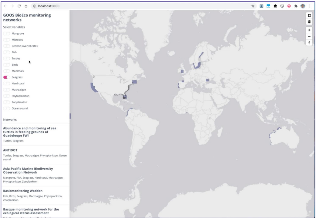
The dynamic landscape of BioEco marine monitoring across Europe necessitates a consolidated overview, enabling informed decision-making and collaboration. The initiative to create a comprehensive map of BioEco marine monitoring networks and capabilities serves this precise need. With this resource in hand, stakeholders can identify active programs, ensuring they harness the potential of existing resources while avoiding redundancy. Such a holistic representation acts as a foundation for bolstering European marine monitoring capabilities, bridging gaps, and highlighting areas of potential synergy.
Impact During the Project
The project focuses on identifying the active BioEco marine monitoring programs in Europe. Creating such a map offers a consolidated and easily accessible representation of all the BioEco marine monitoring initiatives and capabilities across Europe.
Impact Post Project
The map’s long-term implications are two-fold:
Enhanced Cooperation and Interoperability: The consolidated map facilitates better coordination between different monitoring programs. By understanding the geographical spread and the specifics of each initiative, there’s potential for increased synergy between these programs, leading to improved interoperability.
Gap Identification: The map will clearly indicate areas or regions where BioEco marine monitoring is lacking or is not as intensive. This would serve as a basis for future initiatives, ensuring comprehensive coverage and identifying priority areas for expansion or enhancement.
Advancement over and above State of the Art
Consolidated Resource: Traditional monitoring initiatives might be scattered, operating in isolation without a centralized resource. The map of BioEco networks/capability serves as a one-stop reference for all stakeholders, from researchers to policymakers.
Facilitated Collaboration: With a clear view of existing networks and their capabilities, collaboration becomes more streamlined. Institutions or agencies can leverage the strengths of other networks, avoid redundancy, and create a more cohesive marine monitoring strategy.
Data Accessibility: The map can potentially serve as a gateway to data sources, promoting data sharing and accessibility. This is in stark contrast to isolated systems where data might be siloed, making it hard for researchers or policymakers to access comprehensive information.
Strategic Planning: By identifying gaps, the map enables strategic planning for future monitoring efforts. Instead of a haphazard approach, there’s a clear indication of where efforts need to be concentrated, ensuring efficient resource allocation and targeted action.
In essence, the creation of the Map of BioEco networks/capability represents an advancement over the conventional state of marine monitoring by promoting consolidation, collaboration, data accessibility, and strategic planning. This holistic approach ensures that marine monitoring is not just about data collection but also about effective data utilization, collaboration, and informed decision-making.
Links and References
Link to D1.2 – Map of BioEco Networks: https://eurosea.eu/download/eurosea_d1-2_bioeco_observing_networks_v07_resubmitted/?wpdmdl=5500&refresh=650197c36aebc1694603203
Link to D1.4 – Report on EU BioEco Networks: https://eurosea.eu/download/eurosea_d1-4_report_european_bioeco_observing_system_reformatted-2/?wpdmdl=5504&refresh=650197c3dc80d1694603203
