
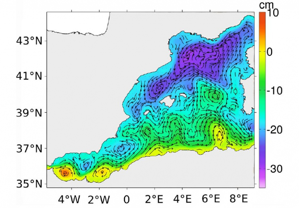
Sea surface height annual mean for 2014 and corresponding surface geostrophic currents from WMOP (Western Mediterranean Operational system) model. (Credit: B. Barceló-Llull et al.)
Space borne and in situ observations provide essential and complementary information on fine-scale ocean structures. One of the scientific goals of the EuroSea Work Package 2 ‘Ocean Observing System Design’ is to improve the design of multi-platform experiments aimed to validate the future Surface Water and Ocean Topography (SWOT) satellite observations of Sea Surface Height, and optimize the utility of these observing platforms. Considering the lessons learnt during a PRE-SWOT multi-platform experiment, the involved EuroSea task team has composed the work plan. The focus will be on two regions of interest for the EuroSea Climate Demonstrator (Work Package 7): the western Mediterranean Sea and the Subpolar North West Atlantic.
To achieve the first objective of ‘Optimizing the design of a multi-platform in-situ experiment to validate SWOT’, the team will evaluate the impact of different sampling strategies in the reconstruction of fine-scale features comparing the simulated and reconstructed observations with the ocean “truth” from the model. The widely used Optimal Interpolation will be used to reconstruct in situ observations. The analysis will rely on different models to provide robustness to the results.
The work on the second objective ‘Compare different methods of reconstruction to validate simulated observations of SWOT’ will consist of the testing of different methods to reconstruct the simulated observations in two configurations: the reference configuration and the best configuration determined in objective 1. Reconstructed fields will be compared with simulated SWOT observations to anticipate the SWOT launch, and assessment metrics will be defined.
The third objective encompasses the ‘Exploration of the capability of the existing observing system networks to validate SWOT’. The aim is to use surface drifters in addition to the traditional nadir altimetry to improve the accuracy and resolution of Sea Level Anomaly maps. The performances of the reconstruction will be evaluated, and it will be analyzed whether this merging is useful for the validation of SWOT. This experiment will also investigate the impact of doubling the number of drifters and quantify the impact in terms of resolution.
Further details are available in the related EuroSea deliverable. Read also our news piece on the research article led by Bàrbara Barceló-Llull, post-doctorate scientist funded by EuroSea.