Blue economy
Development of a strategic vision that promotes enhanced integration across the entire ocean observing value chain, encompassing everything from the design phase of multi-platform observations to the distribution of the data and its assimilation into numerical models, and finally, the delivery of finished products
The creation of a comprehensive and strategic vision for improved integration throughout the ocean observing value chain represents a holistic approach to ocean observation. By considering every phase from design to delivery, this initiative aims to streamline operations, reduce redundancy, and increase the efficiency and effectiveness of the entire value chain.
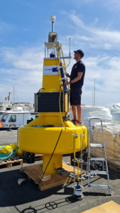
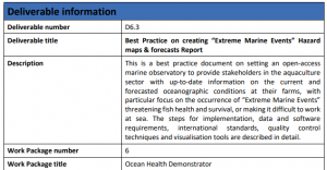
New Monitoring System for Aquaculture with Innovative Buoy Design
The development of a novel monitoring system, specifically designed for aquaculture, integrates sensors to measure vital parameters such as oxygen, temperature, and pH. The system's unique buoy design, coupled with advanced modelling capabilities, offers targeted forecasts of extreme marine events, providing aquaculture operators with an early warning mechanism and actionable insights.
Combining in-situ and satellite for estimation of carbon flux (D7.6)
The integration of in-situ measurements with satellite data offers a holistic and more comprehensive approach to estimating carbon fluxes, which are pivotal in understanding the carbon cycle and its role in global climate dynamics.
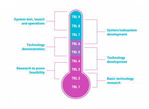
Integration of BGC (Biogeochemical) and DEEP Argo with core missions, aiming to elevate the Technology Readiness Level (TRL) from 5 to higher levels (D3.16)
The endeavour to incorporate Biogeochemical (BGC) and DEEP Argo systems with core observational missions underscores a decisive step toward a more comprehensive and depth-inclusive global ocean observing system. Elevating the Technology Readiness Level (TRL) suggests the transition of these technologies from a prototype stage to broader operational deployment.
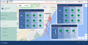
Oceanographic Services for Ports and Cities (OSPAC) Software
The OSPAC software represents a pioneering system designed to offer real-time notifications about marine conditions for ports and urban centres. By providing timely alerts on sea conditions, it stands as a valuable tool for maritime operations, enabling them to make informed decisions and ensuring safety.
Development of Innovative 4D Mapping Methods Using Machine Learning Techniques
4D mapping, which involves 3D spatial dimensions along with the element of time, has traditionally been a complex and data-intensive task. Incorporating machine learning techniques into the realm of 4D mapping represents an effort to enhance data processing, interpretation, and visualization capacities.
Network coordination and integration aimed at enhancing data flow and implementing best practices (as referenced in D3.9, D3.10)
The effort to coordinate and integrate various oceanic observational networks can significantly streamline data flow and fortify the implementation of best practices. This endeavour not only optimizes the collection and dissemination of marine data but also consolidates varied marine observation efforts into a cohesive, more effective system.
Tide Gauge Innovation with Co-design Port/Harbour Operation Products
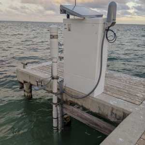
The introduction of a pioneering tide gauge, distinguished by its cost-effective nature and renewable energy power source, marks a transformative shift in tidal monitoring at select European and African sites. Further, the collaborative approach in designing products for port and harbour operations ensures that the developed tools are not only technologically advanced but also tailored to meet specific operational needs.
Co-design Port/Harbour Operation Products
Co-designing involves a collaborative approach where multiple stakeholders, including the end-users, are actively involved in the design process to create products or solutions. In the context of port/harbour operation products, co-design would entail close collaboration between maritime professionals, port authorities, technology providers, and other relevant stakeholders.
Integration of new observational data and advancements in modeling (possibly at a regional scale or using ensemble methods) from EuroSea WP3 into products in CMEMS (Copernicus Marine Environment Monitoring Service) and C3S (Copernicus Climate Change Service)
The integration of new observational data and modelling techniques provides enhanced insights into marine and climate systems. By assimilating this data into CMEMS and C3S, the project ensures that these services are equipped with the most recent and advanced information to deliver accurate and comprehensive marine and climate monitoring.
User-driven, Well Calibrated, Seasonal Forecast Ocean Indicators
The innovative approach here involves developing ocean indicators that are both user-centric and finely calibrated. These indicators pertain to critical oceanic aspects like CO2 uptake/storage, heat content, and acidification. By making these indicators available, the project offers decision-makers a nuanced, timely snapshot of the ocean's state.
Network coordination and integration through workshops to enhance data flow and propagate best practices
Coordinating and integrating different oceanographic networks through workshops is an effective way to enhance data flow and dissemination across platforms. This effort consolidates marine observation initiatives, resulting in a robust and efficient system that ensures a standardized and high-quality approach to marine data collection, sharing, and application.
Network coordination and integration at both EU and global levels with a focus on harmonizing metadata standards, adopting best practices, and ensuring data quality
As marine observation initiatives expand and diversify, the need for structured coordination, especially concerning metadata standards, becomes paramount. By integrating networks at both EU and global scales, there's an increased emphasis on consistency, quality, and efficiency in marine data processes.
Network coordination and integration at both EU and global levels with an emphasis on refining operational procedures and enhancing the metadata inventory
Marine observational initiatives often grapple with operational challenges and data disparities. This project addresses these issues head-on by tightening network coordination across the EU and globally, while placing a marked focus on enhancing operational procedures and building a comprehensive metadata inventory.
Establishment of a robust network of Autonomous Surface Vehicle (ASV) operators along with an integrated data system and a solid framework for best practices
Autonomous Surface Vehicles (ASVs) are pivotal in marine research and observation, offering remote and precise data collection capabilities. This initiative focuses on uniting ASV operators under a cohesive network, creating a streamlined data integration system, and benchmarking a set of best practices for efficient ASV operations.
Reinforcement of the network coordination and governance for augmented observatories, focusing on refining data flow and establishing best practices
Augmented observatories play a pivotal role in marine research and monitoring, harnessing both traditional and novel technologies for extensive oceanic insights. This initiative aims to amplify the coordination within this network, instilling an improved governance system, optimizing data flows, and defining a robust set of best practices.
Enhancement of the Technology Readiness Level (TRL) for forecasting in specialized areas, namely extreme marine events and the merging of biological marine data
Forecasting extreme marine events and merging biological marine data are paramount components of marine research and management. Enhancing the TRL signifies advancements in the methods, technologies, and capabilities in these sectors, indicating a shift from preliminary or pilot phases to more mature operational stages.
Introduction and tracking of “Ocean Best Practices (BP)” within the project, with specific metrics including submission to the Ocean Best Practices System (OBPS), BP under development, new areas initiated by BP, and the tracking process under Work Package 1 (WP1)
Ocean Best Practices play a pivotal role in harmonizing methodologies, tools, and techniques across various marine projects. These practices ensure that marine research and projects are conducted with optimum efficiency, reliability, and consistency. An increase in new and endorsed BP suggests a commitment to enhancing standards and methods in marine research.
Implementation of a multi-platform approach to refine ocean forecasting, resulting in lessons learned, potential new systems, and actionable recommendations
The transition from traditionally singular or isolated ocean observation methods to a multi-platform approach signifies a monumental leap in ocean forecasting. This collaborative strategy integrates data from various sources, capitalizing on the strengths of each platform, to generate more accurate, comprehensive, and timely forecasts.
Creation of a tailored framework to effectively map Essential Ocean Variables (EOVs) and their associated observation requirements
EOVs are critical parameters or sets of parameters that provide a comprehensive assessment of the oceanic state. Historically, the identification, prioritization, and monitoring of EOVs may have been disjointed or lacked a cohesive framework. The creation of a well-defined framework for mapping EOVs represents a structured and systematic approach to enhancing our understanding and monitoring of the ocean.
Development of innovative forecast and reanalysis products
Forecast and reanalysis products form the backbone of predictive and retrospective analyses in various fields, particularly in meteorology and oceanography. Advancing these products means introducing new methodologies, improving resolution, increasing accuracy, and expanding the scope of variables analysed. The innovation could come in the form of enhanced data assimilation techniques, better model resolution, or the incorporation of previously overlooked variables.
Protocol for marine debris observing agreed upon
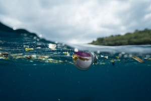
Marine debris, particularly plastic litter, poses a significant threat to marine ecosystems globally. A standardized protocol for marine debris observing would facilitate consistent monitoring, making it easier to assess the scale of the problem and measure the effectiveness of mitigation efforts.
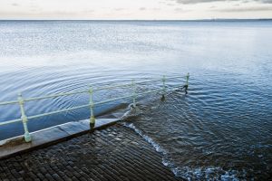
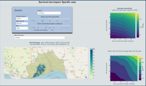
Prototype Sea Level Planning and Scenario Visualization Tool
The tool, designed to aid local authorities and city planners, provides advanced visualization of various sea-level scenarios, enabling better comprehension of potential risks such as flooding. This informed understanding can immensely aid in decision-making processes regarding coastal planning and infrastructure investments.
