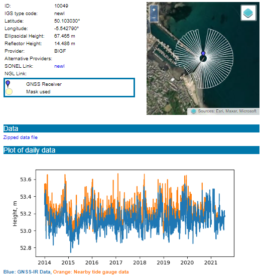
As part of EuroSea Work Package 3 and under co-ordination of the EuroGOOS Tide Gauge Task Team, the UK National Oceanography Centre (NOC) has developed a web portal for global sea level data which have been derived from a novel measurement technique known as Global Navigation Satellite System-Interferometric Reflectometry (GNSS-IR).
GNSS receivers are conventionally used to monitor vertical land motion, but where these instruments are located at the coast, the GNSS-IR technique can be used to infer sea level height from a periodic variation in the signal-to-noise ratio between a direct GNSS signal and its reflection by the sea surface.
Using EuroSea funding, NOC scientists have applied this technique to GNSS data from over 300 locations globally and have incorporated the resulting sea level records and supporting metadata in a new web-based data portal that is hosted at the Permanent Service for Mean Sea Level. This has increased sea level data availability significantly as some of these new sea level records extend back several years. In addition, since GNSS receivers are capable of measuring both sea level and land motion via a single instrument, the new data portal allows scientists to assess the different contributions that are made by each process to the long term trends observed in tide gauge records. This will improve the understanding and predictability of the sea level rise that is associated with climate change.
The data portal also incorporates a tool that allows users to identify suitable locations for new GNSS-based tide gauges and envisage the area of the sea surface that can be observed by an instrument at each location. This could prove to be a very valuable tool for the global sea level community and complements the work that the NOC and Puertos del Estado are undertaking in EuroSea Work Package 5 to design and install 3 state-of-the-art tide gauges in the Mediterranean Sea, which will encompass the GNSS-IR functionality.
Find links to the GNSS-IR Portal and the GNSS-IR Site Map.


