Knowledge transfer
Development of appropriate indicators to monitor and forecast in support of SDG14 (Sustainable Development Goal 14: Life Below Water)
This initiative revolves around the creation and refinement of ocean and climate indicators that can better support the objectives of the Sustainable Development Goal 14 (SDG14) - "Life Below Water." By aligning Essential Ocean Variables (EOVs) with these indicators, the goal is to enhance monitoring capabilities and provide accurate forecasting tools related to marine vulnerabilities and risks.
Forecasts of extreme marine event hazards tailored for aquaculture, focusing on oxygen, heat, and pH ensemble forecasts
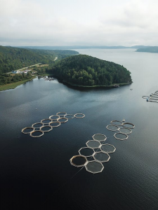
Aquaculture is a sensitive sector that relies heavily on stable marine conditions. Extreme events like sudden temperature shifts, oxygen depletion, and pH changes can lead to significant losses. Having a tailored forecasting system that offers ensemble forecasts for these specific parameters represents a marked improvement over existing systems. The service aims to measure and forecast these specific Extreme Marine Events, assisting aquaculture operators. The output also entails the delivery of assessment systems and the development of outputs such as bulletins. The proposed delivery rate is four extreme marine event assessments per year.
The Oceanographic Services for Ports and Cities (OSPAC) software, specially tailored for port and city usage. This software provides real-time alerts about marine conditions, including significant wave heights and lightning detection data, ensuring better maritime operations and improved safety
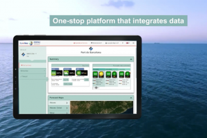
Ports and coastal cities require accurate, real-time information on marine conditions to ensure safe and efficient operations. This software provides real-time alerts about marine conditions, including significant wave heights and lightning detection data, ensuring better maritime operations and improved safety. OSPAC represents an advanced tool designed to cater to this specific need, providing timely alerts on crucial sea conditions, which can have direct operational implications.
Prototype Sea Level Planning and Scenario Visualization Tool
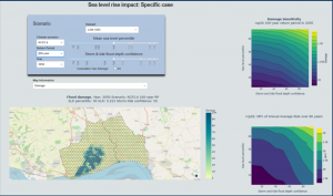
The tool, designed to aid local authorities and city planners, provides advanced visualization of various sea-level scenarios, enabling better comprehension of potential risks such as flooding. This informed understanding can immensely aid in decision-making processes regarding coastal planning and infrastructure investments.
User-driven, Well Calibrated, Seasonal Forecast Ocean Indicators
The innovative approach here involves developing ocean indicators that are both user-centric and finely calibrated. These indicators pertain to critical oceanic aspects like CO2 uptake/storage, heat content, and acidification. By making these indicators available, the project offers decision-makers a nuanced, timely snapshot of the ocean's state.
Improvement of the Tropical Atlantic Observing System (TAOS) for the delivery of ocean products, specifically chlorophyll-a (chl-a) indicators and carbon fluxes
The Tropical Atlantic Observing System (TAOS) plays a crucial role in monitoring and understanding the tropical Atlantic's oceanic conditions. Enhancing its capability to deliver advanced ocean products like chl-a indicators and carbon fluxes can significantly impact a range of sectors and stakeholders.
EuroSea methodologies and Best Practices (BP) in various domains including Extreme Marine Events Hazard maps & forecasts, Network integration, Marine debris observing, Machine learning techniques, Simulated observations from different realistic numerical models, Interoperability, and Visualization of the ocean’s societal relevance and economic role
EuroSea's endeavour to develop best practices in diverse marine research areas symbolizes a collaborative and integrative effort to enhance marine science methodologies and applications.
Development and deployment of tools that consistently and periodically estimate essential carbon metrics
Carbon metrics, especially in the context of the ocean and environment, play a pivotal role in climate science, carbon budgeting, and policymaking. Understanding carbon fluxes, storage, and other metrics is crucial for grasping the Earth's carbon balance and the potential impacts of climate change. The development of advanced tools that can provide regular estimates of these metrics represents a significant leap forward.
Detailed analysis of the influence specific observations have on the accuracy and reliability of ocean forecasts, leading to the generation of recommendations for observation strategies
Understanding the impact of particular observations on ocean forecasts can significantly refine the way forecasts are generated. By analysing which observations contribute most to the forecast's accuracy, one can optimize observational campaigns, resources, and strategies.
T5.1.2 Optimisation of tide gauge and satellite altimetry data in a sea level reconstruction for the Mediterranean Sea spanning 67 years (D5.2)
Sea level projections are crucial for understanding future risks, especially in areas prone to sea level rise. By optimizing both tide gauge data and satellite altimetry data, this effort aims to provide a more accurate reconstruction of sea level changes over a substantial period of 67 years, specifically for the Mediterranean Sea.
