European capacity
Development of a Strategic Vision of Ocean Integration Across the Whole Ocean Observing Value Chain
A comprehensive strategic vision is designed to holistically encompass every aspect of the ocean observing value chain. Central to this vision is the crucial role of data integration and data sharing, emphasizing its significance in ensuring that the entire value chain operates seamlessly and efficiently.
Integrated Data Delivery Chains from Observations to Services
The initiative focuses on establishing comprehensive and streamlined chains to facilitate data transfer from raw observations all the way to actionable services. By integrating various data sources and methodologies, the project aims to provide accurate sea-level projections, communicate associated uncertainties, and outline the consequent financial implications. Two main tasks (5.1.3 and 5.1.2) have been defined to achieve this, addressing sea level projections and the amalgamation of tide gauge with satellite altimetry data respectively.
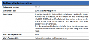
Data Integration Guidelines (D3.17)
The Data Integration Guidelines (D3.17) function as a structured framework designed to streamline the process of consolidating data from diverse sources. These guidelines aim to facilitate more efficient and increased data delivery through major aggregators, namely EMODnet, CMEMS, and SeaDataNet. By optimizing data integration, the guidelines are expected to boost the performance of these platforms, potentially leading to enhanced CMEMS services/products.
Integration of Simulated Drifters and Nadir Altimetry Observations
The integration of simulated drifter data with nadir altimetry observations provides a holistic understanding of surface ocean dynamics. This combined approach aims to refine and potentially revolutionize gridded altimetric products by harnessing the detailed trajectory data from drifters and the broad-scale sea surface height measurements from nadir altimetry.
Simulated Observations of In-Situ and Remote Sensing Data
Utilizing advanced modelling and simulation techniques, comprehensive simulated observations have been generated for a range of in-situ equipment (like CTD, ADCP, gliders, uCTD, drifters, etc.) and remote sensing tools (like nadir altimetry, wide-swath altimetry from SWOT). These simulated observations aim to mirror the characteristics and variability observed in real-world marine environments. Moreover, to promote open access and foster collaborative research, these simulation files will be made publicly available on the Zenodo platform.
Reconstructed Fields from Simulated Observations (OSSEs)
Leveraging simulated observations (OSSEs), reconstructed fields have been derived, capturing dynamic height and geostrophic currents at the ocean surface. These reconstructed fields provide insights into ocean dynamics and circulation patterns based on the simulated observational data. To promote accessibility and collaboration within the scientific community, these reconstructed field datasets will be shared on Zenodo, an open-access platform.
BGC Argo Data Validation Tool
The BGC (Biogeochemical) Argo Data Validation Tool is an innovative software solution designed to ensure the accuracy and reliability of biogeochemical data collected through the Argo network. This tool aims to process, validate, and quality-control the massive amounts of BGC data generated, ensuring it meets the standards for scientific and practical use.
Tide Gauge Data Flow Strategy
The development of a Tide Gauge Data Flow Strategy represents an innovative blueprint for capturing, processing, and disseminating tide gauge data. Given the pivotal role tide gauges play in marine research, hazard monitoring, and climate studies, streamlining their data flows can drastically improve their usability and impact across a range of applications.
New Data Originators Linked to the Project
Within the project's framework, efforts have been made to bring onboard new data originators. These originators play a crucial role in expanding the database by contributing fresh, diverse datasets, thereby enriching the overall data repository and expanding the potential applications of the data.
Comprehensive Training for the EuroSea Consortium in Key Domains
This initiative focuses on strengthening the core competencies of the EuroSea consortium members in three pivotal areas: stakeholder engagement, intellectual property rights management, and effective communication/presentation. By doing so, it aims to bolster the consortium’s ability to execute its projects more effectively and engage with external entities in a more streamlined manner.
Specialized Training for Diverse Users of EuroSea Results
EuroSea, in recognizing the vast potential applications of its results, has initiated a targeted training program for its varied user base. This includes oceanographers, fisheries scientists, aquaculture operators, technical experts, and the upcoming generation of stakeholders. By catering to the specific needs of each group, EuroSea aims to ensure a broader and more effective utilization of its research outcomes.
