Data integration and sharing
Data integration and increased data delivery through aggregators – EMODnet, CMEMS, and SeaDataNet, encompassing a wide array of data flows from tide gauges to augmented observatory data
In a significant leap from current methodologies, this initiative ambitiously consolidates diverse marine and oceanographic data that has traditionally been siloed. The collated data, spanning from tide gauges to advanced observatories, is meticulously harmonized to foster interoperability, creating uniform metadata standards and vocabularies. This mammoth undertaking is primarily anchored in a three-fold collaboration with key aggregators: EMODnet, CMEMS, and SeaDataNet.
Recommendations on observing gaps and design of observing systems to adequately monitor societal relevant indicators
Observing systems and their designs play a crucial role in understanding our environment, particularly the oceanic domain. Current systems, while advanced, have certain gaps that may not capture all indicators relevant to society, such as those linked to climate change, marine biodiversity, or ocean health. The new recommendations focus on identifying these gaps and optimizing the design of observing systems to monitor these societal relevant indicators more comprehensively.
Fostering a Unified Collaboration Among Diverse Scientific Communities for a Cohesive Ocean Observing System
Traditionally, various scientific and engineering communities operated in their silos, often leading to fragmented insights and inefficiencies. This initiative aims to bridge these divides by bringing together a diverse set of stakeholders to collaboratively design a comprehensive and integrated ocean observing system.
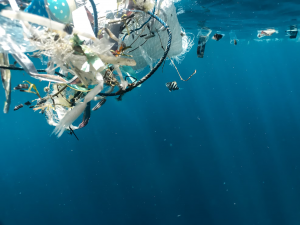
Proposal for global coordination of an Integrated Marine Debris Observing System (IMDOS) developed
Marine debris, including plastic waste, is a growing concern worldwide, affecting marine ecosystems, biodiversity, and human health. Despite the significance of the issue, there has not been a globally coordinated system to observe and measure marine debris comprehensively. The proposal for the creation of IMDOS intends to bring about a standardized, globally-coordinated system that can consistently monitor marine debris and inform policy, conservation, and cleanup efforts.
Recommendations on design of observing system for carbon measurement, based on increased knowledge of regional variability (D7.3)
Carbon measurement, particularly in aquatic systems, plays a pivotal role in understanding global carbon cycles, assessing anthropogenic impact, and developing strategies for climate change mitigation. Traditionally, carbon observations in oceanic systems have been constrained by technological limitations, patchy spatial coverage, and a lack of detailed knowledge on regional variability. The recommendations on the design of the observing system, specifically tailored for carbon measurement considering regional variabilities, marks a significant stride in marine biogeochemistry and climatology.
Enhanced Monitoring Systems via Argo Array and Tropical Moorings Enhancements
This initiative assesses the potential benefits and effectiveness of bolstering the Argo array in Western Boundary Currents (WBC) and equatorial regions, introducing a deep Argo array, and strengthening tropical moorings at the surface layer. It aims to provide a more in-depth and accurate understanding of marine environments in these critical regions.
Added-Value of EuroSea’s In-Situ Observations for Global Monitoring Systems
This initiative emphasizes the unique contributions of EuroSea's in-situ observations in enhancing the capabilities of global monitoring systems. By highlighting the distinctive datasets and observation techniques of EuroSea, it aims to showcase how these specific observations can elevate global marine monitoring standards.
Recommendations on the design of in situ observing system for evaluation of sea surface height and ocean currents with a focus on fine scales and in the context of SWOT altimetry mission validation
The Surface Water and Ocean Topography (SWOT) mission is poised to revolutionize our understanding of the ocean's surface, especially at fine scales. Traditional in situ observing systems and satellite altimetry have limitations in resolving oceanic features at fine scales (10-100 km). The new recommendations seek to enhance the in-situ observation systems to validate and complement SWOT's capabilities, offering a holistic understanding of ocean dynamics.
Assessment of biological networks to support Marine Strategy Framework Directive (MSFD)
The Marine Strategy Framework Directive (MSFD) requires European Union member states to achieve Good Environmental Status (GES) of their marine waters by 2020. Biological networks are integral in this endeavour, offering comprehensive datasets and monitoring capabilities. An in-depth assessment of these networks, accompanied by a strategic mapping exercise, will highlight their significance and provide insights into gaps, overlaps, and opportunities.
Motivating the creation and use of best practices for ocean observing
Ocean observing is paramount for understanding marine environments and predicting changes. However, the effectiveness of these observations' hinges on the adoption of best practices. By motivating the creation and use of such best practices, we ensure that ocean observation becomes more consistent, reliable, and universally applicable.
WP2 – Simulated observations of in situ and remote sensing data
The focus of WP2 is the synthesis and simulation of a comprehensive array of both in situ (like CTD, ADCP, and gliders) and remote sensing (especially nadir altimetry and the cutting-edge wide-swath altimetry from SWOT) observations. This meticulous simulation is further used to construct fields (OSSEs) that include crucial metrics such as dynamic height and geostrophic currents at the ocean surface. An integration of simulated drifters with nadir altimetry observations serves the dual purpose of refining the quality of the gridded altimetric product and advancing our understanding of surface ocean dynamics.
Regional dashboard with maps and metrics for the Mediterranean, Atlantic, and Baltic
The integration of a regional dashboard that displays maps and metrics for crucial marine regions like the Mediterranean, Atlantic, and Baltic offers a centralized platform for stakeholders to visualize and analyse oceanographic data. Such dashboards bring data-driven insights to the forefront, allowing for more informed decision-making related to marine conservation, navigation, and various other oceanic endeavours.
Workshops on ocean modelling and ocean observing
Ocean modelling and ocean observing are two critical components in marine science. While ocean observing is about collecting data from the marine environment, ocean modelling uses this data to create simulations and predictions about ocean behaviour. Historically, these two sectors have worked somewhat in isolation. The introduction of workshops aimed at bridging these two communities represents a significant advancement in collaborative marine science.
Assessment of the benefits of the BOOS-HELCOM integrated system and recommendations for transferring this to other sea areas (D6.6)
The convergence of the BOOS-HELCOM systems represents a significant evolution in marine information frameworks, particularly within the Baltic region. By melding the capabilities of both systems, there emerges a richer, more detailed conduit for marine data, specifically curated for the nuanced needs of policy makers. Furthermore, the process and insights from this integration have the potential to guide similar endeavours in other marine ecosystems, furthering the global understanding and management of our oceans.
